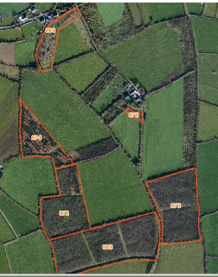
Aerial Picture of Nicharee Farm
Latitude and longitude- 52.23 N 6.63 E
height above sea level- 16m above Mean Sea Level
geology. The farm overlies a narrow seem of Limestone that runs from Duncormick to Wexford Harbour at Drinagh. Running beside the Limestone is a seem of coarse red conglomerate known as Duncormick Conglomerate. In the past it was quarried in Nicharee and used in the building of a number of fine buildings including the Catholic Church in nearby Rathangan.
topography. The farm was overlayed by the Irish Sea Glacier during the last Ice Age, 10,000 years ago. The moving glacier plastered a layer of Glacial Till composed of Irish Sea mud over the underlying rock creating a more or less level plane. A stream runs through the farm and has created a gentle sloped valley such that all fields slope gently down to the stream.
aspect. As there is no major slope the effects of aspect are not extreme ie there are no North facing hills. The stream runs from North to South and so there is a gentle South facing aspect to the whole farm. When siting critical features such as a new orchard or an hugelbed we are careful to face South to maximise the incident solar energy.
drainage. Nicharee has a reputation as being "a wet farm". Over the years many drains have been constructed and the present owners "drained" the whole farm in the 1970's. These drainage efforts did not make it into a dry farm but the rushes that used to predominate have been mostly eliminated.
soil type. The soil type is classed as a "surface water gley". It is typical of the Rathangan soil series that is widespread in South Wexford and Waterford. It is poorly permeable to water and hence the importance of drainage. It is a mineral soil and moderately rich in plant nutrients. It is hoped that holistic grazing and agroforestry can increase the mobility and utilisation of these natural elements.
Latest comments
I am interested to know how long this farm has been established under the name "Nickaree". I am tracing family and I have a Death Record for William Roach, who died: Nickaree, Wexford - 1867
This is the most satisfying stew I have ever had!! Love it! Just tried it last night. I really love the coconut milk, it really made the dish unique.
<a href="https://thebestfucksites.com/">Jayme Silv
I am definitely trying this! That imaginary person at the beginning of your post? Totally me. I work four ten-hour days so I can have 3-day weekends to work on my blog, and by the time I walk in the d
Very tasty looking! I do love cilantro, but I have heard that some people have an aversion to it. Love your photo!
<a href="https://bestdarkwebmarketslinks.com/">Holly Hooper</a>